Légende
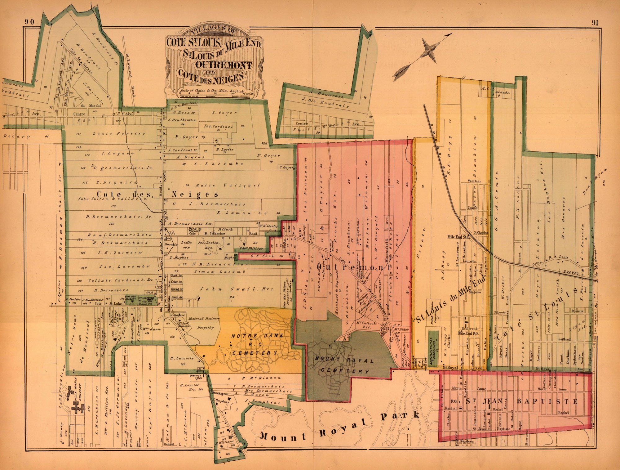
Atlas of the city and island of Montreal, including the counties of Jacques Cartier and Hochelaga from actual surveys, based upon the cadastral plans deposited in the office of the Department of Crown Lands / [document cartographique] ; by and under the supervision of H.W. Hopkins. Provincial Surveying and Pub. Co., Henry W. Hopkins, manager,1879.
Source
Bibliothèque et Archives nationales du Québec