Légende
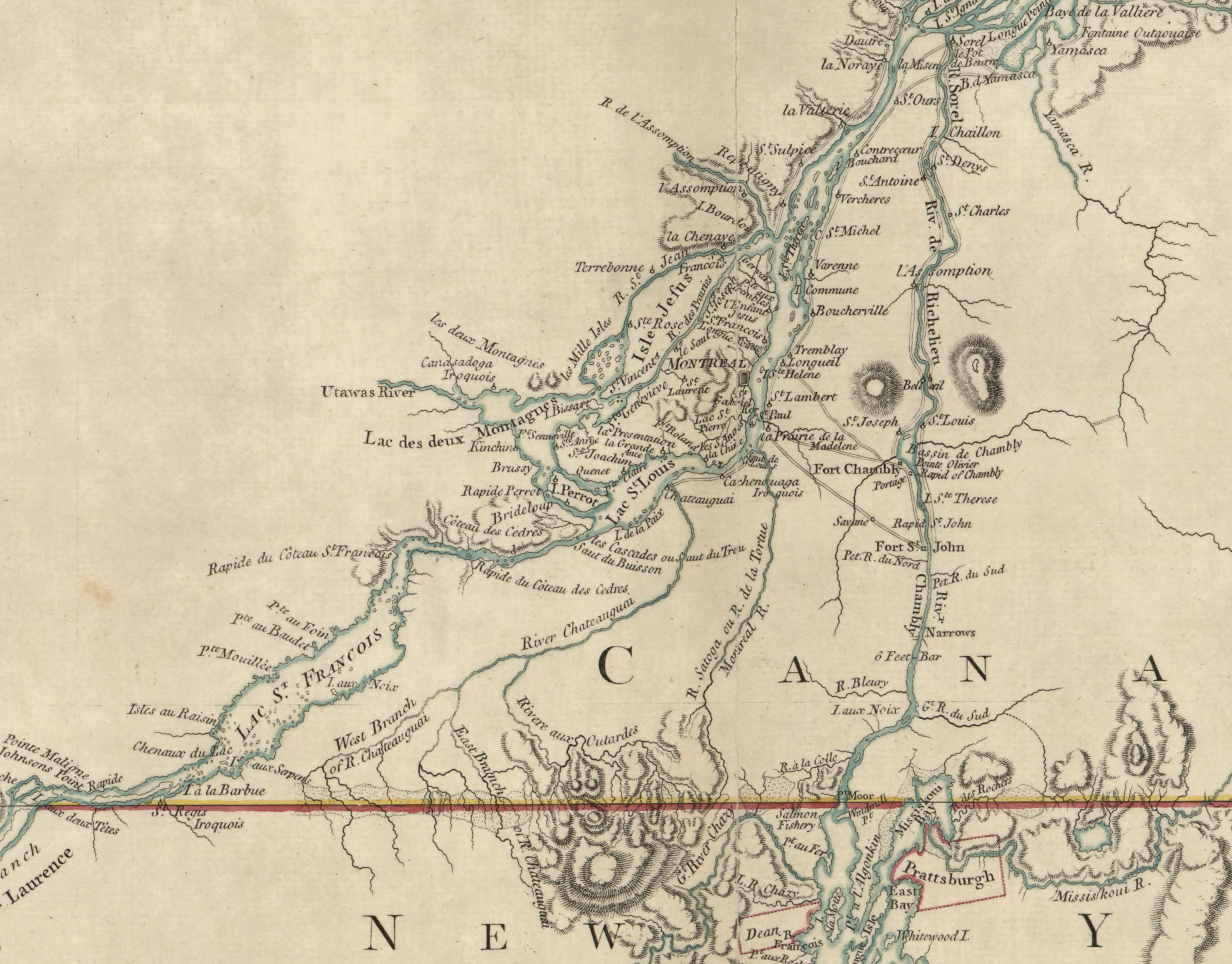
Faden, William, and Claude Joseph Sauthier. A map of the inhabited part of Canada from the French surveys, with the frontiers of New York and New England. London, 1777. Map. https://www.loc.gov/item/73695741/.
Source
Library of Congress Geography and Map Division Washington, D.C.