Menu
Categories
Arts and Sports
Heritage and History
Libraries
Parks and Nature
Shows and Exhibitions
Sports and Recreation
Business and Innovation
City Suppliers
Funding and Assistance
Innovation and Research
Permits and Authorizations
Community
Awards and Distinctions
Diversity
Neighbourhood Life
Prevention and Social Action
Universal access
Democracy and Engagement
Public Consultations
Resident Initiatives
Environment
Air
Collections and recycling
Ecological Transition
Soil
Trees and Gardens
Water
Finance and Taxes
Budget and Financial Profile
Municipal Taxes
Property Assessment
Health and Public Safety
Disaster Risks
Police and Firefighters
Public Health
Homes and Housing
Buying and Selling a Home
Homes
Outdoor Development and Maintenance
Renovation and Construction
Maintenance and Traffic
Cleanliness
Construction and Street Closings
Snow Removal
Travel and Transportation
Municipal Administration
Administration
Boroughs
City Hall and Elected Officials
Jobs
Organizations and councils
Publications and Data
Pets and Insects
Pets
Wildlife and Insects
Rights and Legislation
Claims and Complaints
Tickets and Appeals
Urban Planning and Development
Urban Design
Urban Projects
Services
Points of Service
Parks
Libraries
Ecocentres
Municipal Arts Centres
Sports Facilities
Calendar
All Events
Councils and Committees
Public Consultations
Arts and Sports
Contact Us
311
The Mayor
Elected Officials
Media Relations
Search
Clear
Search
News feed
My services
My requests
My tasks
My profile
My account settings
My notification preferences
Services
Applications and Requests
Tasks
Activity log
Members
Information
Logout
My account
Français
Home page
Master Plan
Introduction
Part I
Part II
Part III
Part IV
Appendices
Maps
Modifications to the Master Plan
Glossary
Related documents
Links
Site map
Master Plan
> Maps
Maps
Introduction
Montréal and the Communauté métropolitaine de Montréal
Chapter 1
Map 1.1
Established areas, areas to be built and areas to be transformed
Chapter 2
Map 2.1.1
Revitalization areas
Map 2.1.2
Major retail components
Illustration 2.1.1
Residential development potential
Map 2.2.1
Public transportation
Map 2.2.2
Areas deemed for intensification
Map 2.2.3
Road network
Map 2.2.4
City-wide bikeway network
Map 2.2.5
Major rail, port and airport freight transportation infrastructure
Map 2.3.1
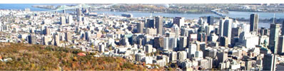
The Centre and its surroundings
Illustration 2.3.1
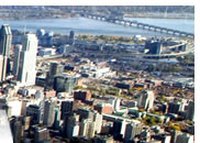
The Central Business District
Illustration 2.3.2
Commercial streets to be consolidated
Map 2.3.2
An inhabited Centre
Map 2.3.3
Key roadways of the Centre
Map 2.4.1
Employment areas
Illustration 2.4.1
Business and retail districts to be densified while creating new public transit corridors
Illustration 2.4.2
Employement areas to b redeveloped while making structural interventions to the road network
Illustration 2.4.3
Large abandoned industrial sites to be developed as employement areas
Illustration 2.4.4
Areas suited for transformation to mixed-use activities
Broad vistas and framed views of interest (1)
Broad vistas and framed views of interest (2)
Illustration 2.5.1
The waterside roadway
Map 2.5.1
Parks and green spaces
Illustration 2.5.2
The settlement routes
Illustration 2.5.3
The city's gateways
Illustration 2.5.4
Main thoroughfares
Heritage sites
Illustration 2.6.1
Industrial heritage
Map 2.6.1
Built heritage
Map 2.6.2
Archaeological heritage
Illustration 2.6.2
Nature parks
Map 2.6.3
Natural heritage
Illustration 2.7.1
The quality of lake and river water
Illustration 2.7.2
Land use constraints related to the Airport
Illustration 2.7.3
Flood-prone areas
Illustration 2.7.4
The Lafarge quarry and the former quarries
Illustration 2.7.5
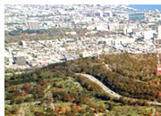
Saint-Jacques Escarpment
Illustration 2.7.6
Overhead power lines
Chapter 3
Map 3.1.1
Land use designation
Map 3.1.2
Building density
Chapter 4
4.1 Airport Surroundings
4.2 CP tracks Surroundings
4.3 Angrignon
4.4 Autoroute Ville-Marie
4.5 Crémazie
4.6 Pie-IX
4.7 Bourget / Forget
4.8 Lachine Canal
4.8.1 Griffintown
4.8.2 East Lachine
4.9 Côte-de-Liesse
4.10 Central Business District
4.11 Olympic Complex and Village
4.12 Louis-H. La Fontaine Corridor
4.13 Décarie / Cavendish / Jean-Talon West
4.14 Galeries d’Anjou / Jean-Talon East
4.15 L ’Anse-ŕ-l’Orme
4.16 L ’Acadie / Chabanel
4.17 L'Anse-ŕ-l'Orme
4.18 Laurentien / Lachapelle / Marcel-Laurin
4.19 Meadowbrook
4.20 Mount Royal
4.21 Notre-Dame Est
4.22 Quartier des spectacles
4.23 Indoor Pedestrian Network
4.24 Glen and Turcot sites
en