|
|
 |
|
The building density parameters guide architectural design by determining the scale of the built form and the intensity of activities in different areas of the territory. The approach to determining density is flexible and gives boroughs the necessary latitude to efficiently carry out day-to-day management of projects.
The parameters for each area to be built or transformed reflect the character sought by the Plan. In established areas, the parameters correspond to the general character of the existing built environment, which the Plan seeks to maintain.
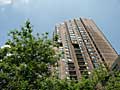
Map 3.1.2 shows the building density for the entire City in a 17-colour scheme that reflects the various density parameters. The 27 map excerpts included in Part II of the Plan come with a description of the parameters that apply to each area. These parameters describe the existing or desired general character of an area, based on one or more of the following :
- The number of aboveground storeys (excluding mezzanines);
- The type of configuration: detached, semi-detached or row;
- The building site coverage ratio;
- The floor area ratio (F.A.R.), especially in areas to be built or transformed.
The principles by which the different building density parameters will be applied are as follows:
- The precise boundaries of the areas presented on the Building Density Map presented in Part II of the Master Plan must be interpreted in light of streets and alleys, as well as the cadastral limits applicable at the moment of the Plan’s adoption;
- The different construction density zones and their associated regulations are specified in the zoning by-laws as a function of the typology of the built form and the characteristics of their surroundings. These are formulated with particular attention to the homogenous built form of street segments or a group of blocks, or even the predominant character of certain major axes;
- The zoning by-law defines height limits by number of storeys, meters or both, according to the vocation and character of the area;
- The zoning by-law may define a minimum height in meters equivalent to the height prescribed in storeys where the land use is “Employment Area,” “Mixed-Use Area,” “Large Institutional Facility,” or “Convent, Monastery or Place of Worship”;
- The permissible construction density is expressed in terms of floor area ratio (F.A.R.), the ratio between the total floor area of a building and the total surface area of its lot;
- The following elements are excluded when calculating the building density of a new project :
- Space used for mechanical systems and underground storage;
- Floor space used for underground parking lots;
- The floor area of ground-floor businesses directly accessible from Rue Sainte-Catherine shown on illustration 2.3.3;
- Floor space used by features intended to increase user comfort in an already-constructed building (analyzed on a case-by-case basis);
- A cultural facility, under certain conditions - in particular, those pertaining to the type of facility and its durability - in the Quartier des spectacles;
- The structural transfer storey of a construction project spanning a structure of the Metro or of a below-grade freeway, in the Ville-Marie Borough;
- The floor area of a greenhouse used for the purposes of industrial or commercial plant cultivation and located on the roof of a building in Ville-Marie borough.
en
| |
|
|
|