|
|
 
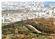
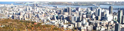
Public Transportation in Montréal
Even though its modal share has declined, public transportation is heavily used in Montréal as compared with other large North American agglomerations. Montrealers average 222 trips by public transportation per year, compared to 210 in Toronto and an average of 63 in major American cities (New York, Boston, Chicago, Detroit, Denver, Houston, Los Angeles, Phoenix, Portland, San Diego, San Francisco, Washingto , Sacramento).
Growth in population and number of cars per household
Between 1982 and 1998, the population of the Island of Montréal remained stable at approximately 1.8 million, while the number of households increased by approximately 9% from 709,500 to 772,000 due to a drop in the number of people per household. During that same period, the number of cars owned by Montrealers rose from 581,200 to 707,600 – a 22% increase – with the ratio of cars per household increasing from 0.8 to 0.9.
|
 |
|
3
Consolidate and develop Montréal’s territory in relation to existing and planned transportation networks
Major Trends
Travel within the Montréal Census Metropolitan Area (CMA) is on the rise. From 1982 to 1998, the number of daily trips within the CMA climbed from 6.2 to 8.9 million. During the same period, trips within Montréal itself rose from 4 to 5 million. By 2016, the MTQ projects that approximately two million more daily trips will be added to the 8.9 million observed in the CMA in 1998. However, although overall mobility has increased since 1982, the relative weight of daily trips in Montréal has dropped due to an even steeper rise in the number of trips in the suburbs.
As the graphics below indicate, this travel increase is accompanied by a significant rise in automobile mode split and a corresponding sharp drop in public transportation mode split.
The MTQ estimates that automobile use will continue to rise unless action is taken to counter-balance this trend. Congestion on the expressway network in the central part of the Island is already spilling over into the local network, which in many areas is incapable of absorbing any additional traffic.
Public transportation networks are also heavily used, especially in the peak direction (for example, towards the Centre in the morning), which causes a certain amount of discomfort for users. During the same period, some segments are not used at full capacity, particularly in the opposite direction of the peak.
The Plan sets forth two objectives relative to existing and planned transportation networks:
| 3.1 |
 |
Facilitate travel between different areas of the City by establishing new public transportation services
|
|
| 3.2 |
|
Promote urban development that favours the use of public transportation
|
|
| 3.3 |
|
Strategically connect areas of the City by completing the road network
|
|
| 3.4 |
|
Complete the City-wide bikeway network to provide access to activity areas and public transportation infrastructure
|
|
| 3.5 |
|
Promote urban development and the use of public transportation and bicycles by taking action on the supply of parking
|
|
en
| |
|
|
|