16.1
Preserve and enhance natural environments by ensuring their harmonious integration into urban development
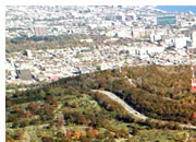
The City recognizes that, apart from currently protected areas, there are natural, ecological and scenic assets worth preserving, such as woods, streams, riverbanks and wetlands. As viable ecosystems and habitats for a variety of fauna and flora, these natural environments help increase the biodiversity of Montréal’s territory. By contributing to Montrealers’ quality of life and enriching the urban landscape, these areas also play an active role in Montréal’s economic vitality, notably by making it more attractive as a place to live and play.
The City therefore intends to attach more importance to natural environments in designing urban development projects. It will seek to reconcile the environmental, social and economic benefits stemming from their enhancement. Thus the Master Plan supports the Politique de protection et de mise en valeur des milieux naturels (Policy respecting the Protection and Enhancement of the Natural Environment). In this regard, it recognizes the ten ecoterritories identified in Map 2.6.3 as well as the associated conservation and development objectives (see Table 2.6.1).
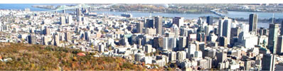
Four ecoterritories are also taken into account in the Detailed Planning Areas discussed in Chapter 4: L’Anse-à-l’Orme, the Saint-Jacques escarpment, Mount Royal and the Louis-H.-La Fontaine corridor.
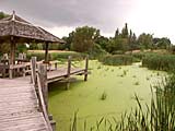 Moreover, the City intends to pay special attention to ensuring the sound management of stormwater runoff on its territory and maintaining the integrity of the water regime of its streams. In recent years, water quality along riverbanks has greatly improved. Nonetheless, it remains affected by the condition of some storm and sanitary drainage infrastructure (see Objective 18). Also, the viability and quality of Montréal’s streams is greatly affected by the channelling and relocation of waterways, as well as by the uncontrolled increase in paved surfaces. Map 2.6.3 shows the main streams and wetlands within Montréal’s territory.